Experts in GIS solutions

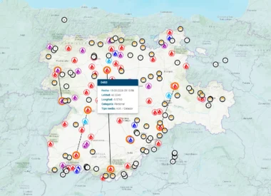
FLAMA: Driving a new era of wildfire management in Aragon
Vexiza integrates mapping, weather, and workforce management data into one unified platform to improve response to any wildfire-related incident in Aragón.
Integrated Wildfire Management System
Explore in detail the comprehensive fire management tool we have designed for the dispatch and monitoring of resources for the fight against forest fires for the Government of Navarre.
Retechfor: Building the Future of Wildfire Management
Vexiza supports the development of innovative wildfire management technologies as part of the Retechfor program
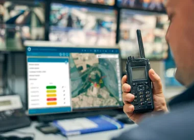
Empowering Decision-Making with Cloud Based Data and Mapping Analysis Solutions

Master complex situations with confidence and agility.
Reduce response times to any situation or emergency.
Visually interact with large volumes of information in real time

Effortlessly explore extensive data on maps to make decisions with confidence and certainty
Certified Partners

