Comprehensive Management of Fires in the Chartered Community of Navarre

The Autonomous Community of Navarre had a management system, resource dispatching, and fire monitoring integrated into the 112 emergency system, but it lacked all the tools needed by the teams in charge of extinguishing tasks.
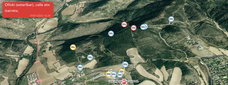
To improve incident planning and resolution capabilities, Vexiza has provided the Chartered Community of Navarre with a unique platform for forest fire management, where all technicians and brigade chiefs can access all tools for planning air and ground resources, real-time monitoring of extinguishing teams, and meteorological information within a maximum of 3 clicks.
Users receive all the information they need without delay and in an automated manner, so the time spent analyzing the situation is minimal, which is key in the midst of a forest emergency.
This way, it’s possible to access all information related to the management of relief and mandatory rest periods for extinguishing teams, as well as flight plans, in just a few seconds, greatly simplifying resource management.
Added to this is the ability to understand from the platform the evolution of the meteorological variables most influential in the fire’s development; and the capability to simulate the fire’s progress over the next 24 hours, which allows for identifying areas to focus efforts on, as well as the best road access and evacuation routes for the population.
In summary, a comprehensive tool that covers all the needs of all the devices responsible for coordinating and managing the response to forest fires.
If you need tools to optimize your fire prevention and management capabilities, contact us.