Master your environment with accessible weather forecasts
weather variables
weather fire indexes
days of weather analysis coverage

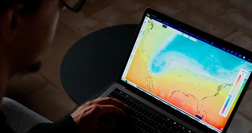
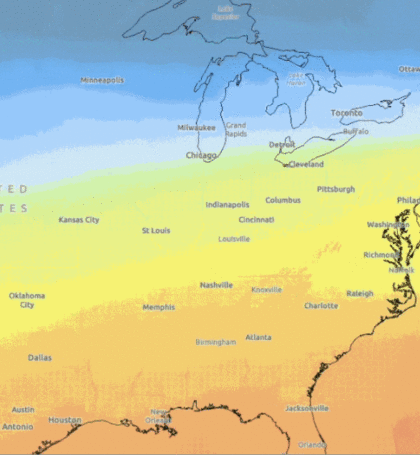
To make the analysis of meteorological data accessible to any professional, regardless of their background, Vexiza has developed Weather Map Site, a platform that allows to easily visualize the evolution of over 100 meteorological variables. With just a few clicks, anyone can access to real-time and forecasted atmospheric conditions worldwide for the next 2 or 10 days, using captivating animations.
In addition, to simplify even more data analysis and facilitate decision-making, our mosaic view allows you to visualize the evolution of up to 12 variables simultaneously, providing a comprehensive global risk assessment.
Finally, Weather Map Site also has a dedicated section for measuring the impact of meteorology on the risk and development of wildfires. Developed exclusively in conjunction with the Castilla y León Supercomputing Center, the platform features a customized version of Canadian weather indexes, delivering hourly updates on fire risk levels for any location.
Lastly, the platform also features a fire simulator that automatically processes all the meteorological data of the area in which a forest fire has broken out, enabling it to swiftly predict its most likely evolution by simply entering the origin coordinates. Firefighters are thus able to know, quickly and accurately, the areas where they should focus their efforts.
If you want to know more about how Vexiza can help your company with accessible weather forecasts, please contact us.